The Learning Forest Spring 2025 Issue
The 17th issue of the Learning Forest was recently published, which is a collaboration between DNR’s Olympic Experimental State Forest (OESF) Research and Monitoring Program and the University of Washington’s Olympic Natural Resources Center (ONRC) to share scientific knowledge on sustainable land management. In this issue, we discuss the use of a custom bioacoustics classification model for identifying bird songs and calls from passive acoustic monitoring recordings. These recordings are part of a project to create complex early-seral habitat in the OESF. This issue also profiles the work of the Pacific Coast Salmon Coalition to improve off-channel habitat and restore fish passage on a stream in the OESF. We also provide information about the T3 Watershed Experiment, recent publications, education and outreach efforts, and more. Read the full issue here.

The Learning Forest Fall 2024 Issue
In this issue, the authors discuss how a model built with LiDAR data can be trained to distinguish between Douglas-fir and western hemlock trees, which could be a boon for forest planning, monitoring, and habitat assessments. This issues also includes details on a new tool for identifying and mapping forested wetlands and its importance to soil carbon estimates. This issue also includes information about the Type 3 (T3) Watershed Experiment, recent publications, education and outreach efforts, and more. Read the full issue here.

Master’s Thesis on locating western redcedar trees on the Olympic Peninsula
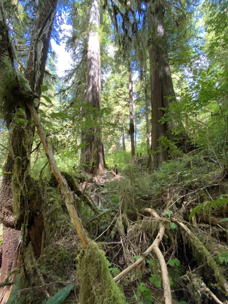
Ally Kruper recently finished her master’s thesis using drone-based lidar and multispectral imagery to locate western redcedar, a culturally, ecologically, and economically important conifer species.
Abundance of western redcedar on the landscape today is a fraction of what it was historically due to a combination of overharvesting in the 20th century, incompatibility with short-rotation forestry, cedar browse by ungulates, and a documented western redcedar dieback phenomenon linked to climate change. Restoring cedar will rely on our ability to map western redcedar trees on the landscape, particularly using tools such as remote sensing that have larger spatial coverage capabilities. Interested in learning more? Read her full thesis here.

The Learning Forest Spring 2024 Issue
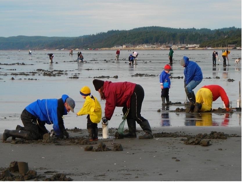
In this issue, we profile the Washington Needlecast Working Group, which is addressing a fungal tree disease called Swiss needle cast in Douglas-fir forests; and the Olympic Region Harmful Algal Bloom partnership, which is addressing harmful algal blooms in coastal waters. This issue also includes information about the T3 Watershed Experiment, recent publications, education and outreach efforts, and more.
Read the full issue here!
T3 Watershed Experiment Implementation Report
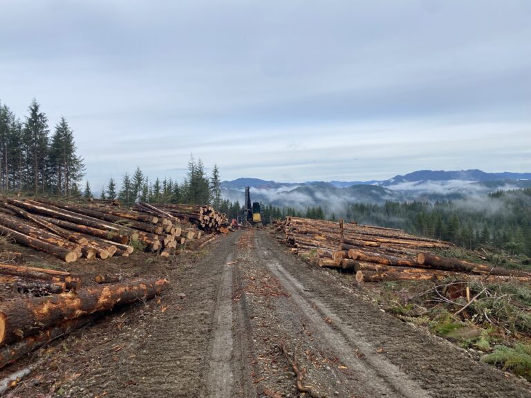
Principal investigators from the T3 Watershed Experiment recently released a study implementation report summarizing the activities in the experiment from 2016-2023, the rationale behind major decisions, and the lessons learned so far. Read the full report here.
New Stream Food Web Model for the T3 Watershed Experiment
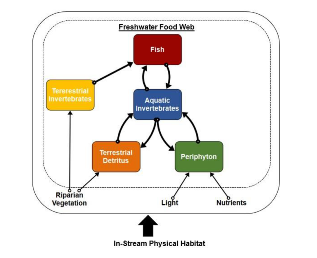
T3 Collaborators Emily J. Whitney, J. Ryan Bellmore, and Joseph R. Benjamin finalized a report on their new stream food web model created to predict responses of the riparian prescriptions of the Type 3 Watershed Experiment to assess the potential impacts of current and alternative forest management strategies on stream food webs. Read the full report here.
The Learning Forest Fall 2023 Issue
Twice a year, WA Department of Natural Resources and ONRC put out a joint newsletter highlighting the great work occurring in the Olympic Experimental State Forest. In this issue of The Learning Forest, the feature article includes information on the ways the Type 3 Watershed Experiment is incorporating feedback gained through learning-based collaboration into management prescriptions that are focused on ethnoforestry. In addition, the guest article includes information on the new natural resources program offered at Peninsula College. Check out the full issue here.

New Report on Red Alder as a Potential Nature Climate Solution
Over the last four years, the Nature Conservancy’s Emerald Edge Program has facilitated an Alder Working Group comprising a broad range of stakeholders. They explored possible uses of red alder in economic development, ecological improvement, and as a potential natural climate solution. They identified gaps in our scientific knowledge and were interested in additional research on the topic. This led to a research group forming, comprised of ecologists, silviculturists, and life-cycle assessment experts from the University of Washington and Oregon State University. Read the completed report here.
The Learning Forest Spring 2023 Issue
The latest edition of the ONRC and WA DNR collaborative newsletter, the Learning Forest, is out! This issue highlights a new study plan developed as part of the T3 Learning Groups to research various browsing mitigation techniques to protect Western redcedar seedlings. The guest article features the incredible work of Dr. Korena Mafune as she studies soils in the canopies of bigleaf maple trees on the outer Olympic Peninsula. This issue is full of exciting new research and findings in and around the Olympic Experimental State Forest.
Check out the full issue of the Learning Forest here.


New publication evaluating the Wind River historic alder strip
ONRC Director Bernard Bormann led an evaluation of a historic alder strip planted at the Wind River Experimental Forest in southern Washington. Using aerial LiDAR, the research team detected differences in tree heights and site index within and outside this strip, indicating that red alder (that has since died) is having long lasting affects that benefit the current stand. Read the full article published in Forest Ecology and Management here.
Title: The Wind River alder strip revisited: Lessons for post-fire management on recent and future western Washington and Oregon fires.
Authors: Bernard T. Bormann, Courtney R. Bobsin, Robert J. McGaughey, John C. Gordon, Brett A. Morrissette, and Ally Kruper.
Abstract: A forester set up a large-scale, 1600-m fire-break trial with red alder (Alnus rubra Bong.) inter-planted between Douglas-fir (Pseudotsuga menziesii Mirb Franco), after the extensive 1927 Yacolt Burn in the Columbia Gorge. This now 90-year-old trial demonstrates dramatic effects of alder on soils and growth of Douglas-fir; it also provides a timely lesson for foresters deciding what to do after recent similar fires in western Oregon and Washington. We used 2015 airborne lidar to re-examine the trial effects. Douglas-fir trees in stands mixed with alder (Strip) continue to grow taller than those in adjacent pure stands (Controls), even though almost all alder died out 30–40 years ago. Site index in Strip stand continues to increase relative to Controls, now averaging 30–40 % higher than Controls. Basal area ha− 1 is 2.1, and stem biomass is 2.8 times higher in Strip than Control stands. Implications and future studies are discussed. Before planting wall-to-wall Douglas-fir, foresters responding to new fires in this region might contemplate alder interplanting and crop rotation for their likely positive effect on future revenue, wildlife, and carbon sequestration rates and storage above and belowground.

New Ethnoforestry Publication
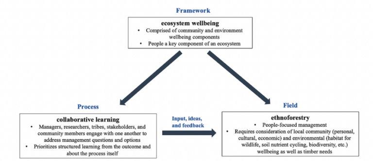
A new paper was recently published in the journal Forest Ecology and Management that details the ways ethnoforestry, an ecosystem wellbeing framework, and collaborative learning, have been used in the Type 3 Watershed Experiment. Read the full article here!
Title: Perspectives: Ethnoforestry, ecosystem wellbeing, and collaborative learning in the Pacific Northwest
Authors: Courtney R. Bobsin, Bernard T. Bormann, Marc L. Miller, Bryan D. Pelach
Abstract: The field of forestry has changed substantially in the last 100 years as scientists and managers have grappled with ways to best manage forests and adapt to changing knowledge, needs, and climates. We believe a path forward may be through using an ecosystem wellbeing framework where both community and environment wellbeing must be achieved to meet ecosystem wellbeing goals. To achieve this, we used a collaborative learning process where managers, researchers, tribes, and stakeholders engage with one another to ask and answer questions about options and effects of management choices. We also propose the use of the field of ethnoforestry, or a people-focused forest management, as the necessary way to apply the input, knowledge, and feedback gained through the collaborative learning process. We offer two examples of ways ethnoforestry is being tested on the Olympic Peninsula through an operational-scale experiment that seeks to meet the needs of communities and the environment, while producing revenue for trust land beneficiaries and meeting late seral habitat requirements.
The Learning Forest
The University of Washington and the Washington State Department of Natural Resources’ Olympic Experiment State Forest’s (OESF) bi-annual newsletter called the Learning Forest details research and work occurring within the OESF. Click the link below for the latest issues of the newsletter.
Red Alder Publication
A recent paper published in the journal Remote Sensing shows a new approach to identifying red alder trees using aerial LiDAR. This paper, led by ONRC master’s student Ally Kruper, can have implications for monitoring long-term and large-scale research going forward through this remote sensing approach. Read the full paper here!
Title: Using airborne LiDAR to map red alder in the Sappho long-term ecosystem productivity study.
Authors: Ally Kruper, Robert J. McGaughey, Sarah Crumrine, Bernard T. Bormann, and Courtney R. Bobsin
Abstract: A fundamental question of forestry is that of species composition: which species are present, and which are not. However, traditional forest measurements needed to map species over large areas can be both time consuming and costly. In this study, we combined airborne light detection and ranging (LiDAR) data with extensive field data from the Long-Term Ecosystem Productivity study located near Sappho, Washington, USA to increase the accuracy of our GIS data and to differentiate between red alder (Alnus rubra Bong.) and other dominant tree species. We adjusted plot and tree locations using LiDAR canopy height models (CHMs) by manually matching tree canopies on the CHMs with tree stem maps based on field data. We then used the adjusted tree locations and metrics computed from LiDAR point cloud data to create a classification model to identify and map red alder. The manual matching of field stem maps to CHMs improved tree locations, allowing us to create model training data. These data were used to create a random forest model that discriminated between red alder and conifer species with an accuracy of 96%. Our findings highlight the potential of LiDAR to improve coordinates of individual trees as well as discriminate between selected coniferous and deciduous tree species using LiDAR data collected in leaf-off conditions in Pacific Northwest ecosystems.
PNW HAB Bulletin
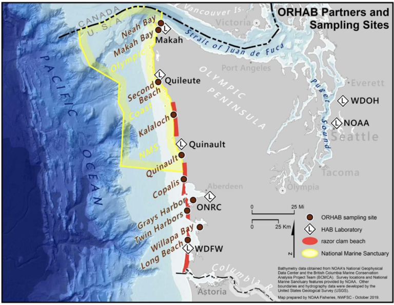
The Olympic Region Harmful Algal Bloom (ORHAB) Partnership’s beach and offshore data provides early warnings of HABs to coastal shellfish managers. Click the link below to see the latest Pacific Northwest HAB Bulletin publication.
Quileute Tribe Water Monitoring Program
“The Quileute Tribe is gathering and using data on stream sediment, temperature and dissolved oxygen to answer critical questions and take actions to protect water quality in the Quillayute River in Washington. This work is funded with an annual grant of approximately $72,000 from EPA’s Region 10 office under Section 106 of the Clean Water Act.”
Learn more about this local program at: https://www.epa.gov/r10-tribal/quileute-tribe-water-monitoring-program